Abstract's details
New Global Marine Gravity from CryoSat-2 and Jason-1 Reveals Buried Tectonic Structure
Event: 2014 Ocean Surface Topography Science Team Meeting
Session: The Geoid, Mean Sea Surfaces and Mean Dynamic Topography
Presentation type: Poster
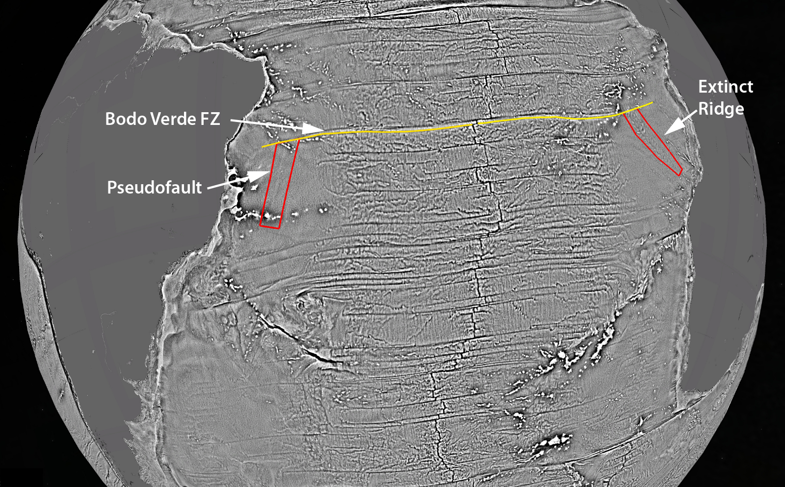
Marine gravity anomalies derived from satellite radar altimetry provide a moderate resolution and global view of ocean basin tectonics and continental margin structure. Over the past four years radar altimeters (CryoSat-2 and Jason-1) have provided a factor of 2 improvement in the accuracy of the marine gravity field. This lower noise level combined with improved spatial resolution reveals previously unknown tectonic structures buried beneath thick sediments of the older ocean basins and continental margins. This paper highlights two areas where previously unmapped structures have been discovered. The first is the position of the extinct spreading ridge and continent ocean boundary (COB) in the Gulf of Mexico. The second is a major propagating rift in the South Atlantic Ocean. This study provides open access to the global data grid for other tectonic studies.
Figure - New marine vertical gravity gradient (VGG) map derived from satellite altimetry highlights fracture zones crossing the South Atlantic Ocean basin (e.g. yellow line). Areas outlined in red are small amplitude anomalies in areas where thick sediment has diminished the gravity signal of the basement topography. The full resolution gravity anomaly and vertical gravity gradient models can be viewed in Google Earth using the following files: (ftp://topex.ucsd.edu/pub/global_grav_1min/global_grav.kmz ) (ftp://topex.ucsd.edu/pub/global_grav_1min/global_grav_gradient.kmz ).
The grids are available at the following ftp site (ftp://topex.ucsd.edu/pub/global_grav_1min).
Contribution: ostst_2014_marine_gravity_sm.pdf (pdf, 5576 ko)
Back to the list of abstract