Abstract's details
Optimal parameters for mapping alongtrack altimetry
Event: 2023 Ocean Surface Topography Science Team Meeting
Session: Instrument Processing: Propagation, Wind Speed and Sea State Bias
Presentation type: Oral
The question of generating optimal maps of sea surface height from alongtrack altimetry is examined though both theory and numerical experiments, considering for simplicity only Jason-class altimetry. The framework of Local Polynomial Fitting (LPF) is proposed as a mapping solution with numerous advantages over the more familiar Optimal Interpolation (OI): it requires fewer a priori assumptions; it is easy to keep track of exactly what is being done with the data; its performance and error properties are well understood thanks to a large theoretical literature; it is much faster due to the inverted matrix being orders of magnitude smaller; and finally, since all linear methods are in a sense equivalent, the use of a sufficiently large parameter space in local polynomial fitting would not exclude any possibilities that one might alternately express via OI.
Map fidelity is tested within the context of an Observing System Simulation Experiment, or OSSE, together with a new, general form for the weighting kernel and newly derived error expressions. Minimizing globally-averaged mean square error over thousands of different choices of parameters leads to the identification of an optimal choice. The resulting maps, based on only Jason-class altimetry, rival the standard CMEMS product in quality despite using only a fraction of the data; this suggests the potential for considerably improved maps through a refined mapping algorithm.
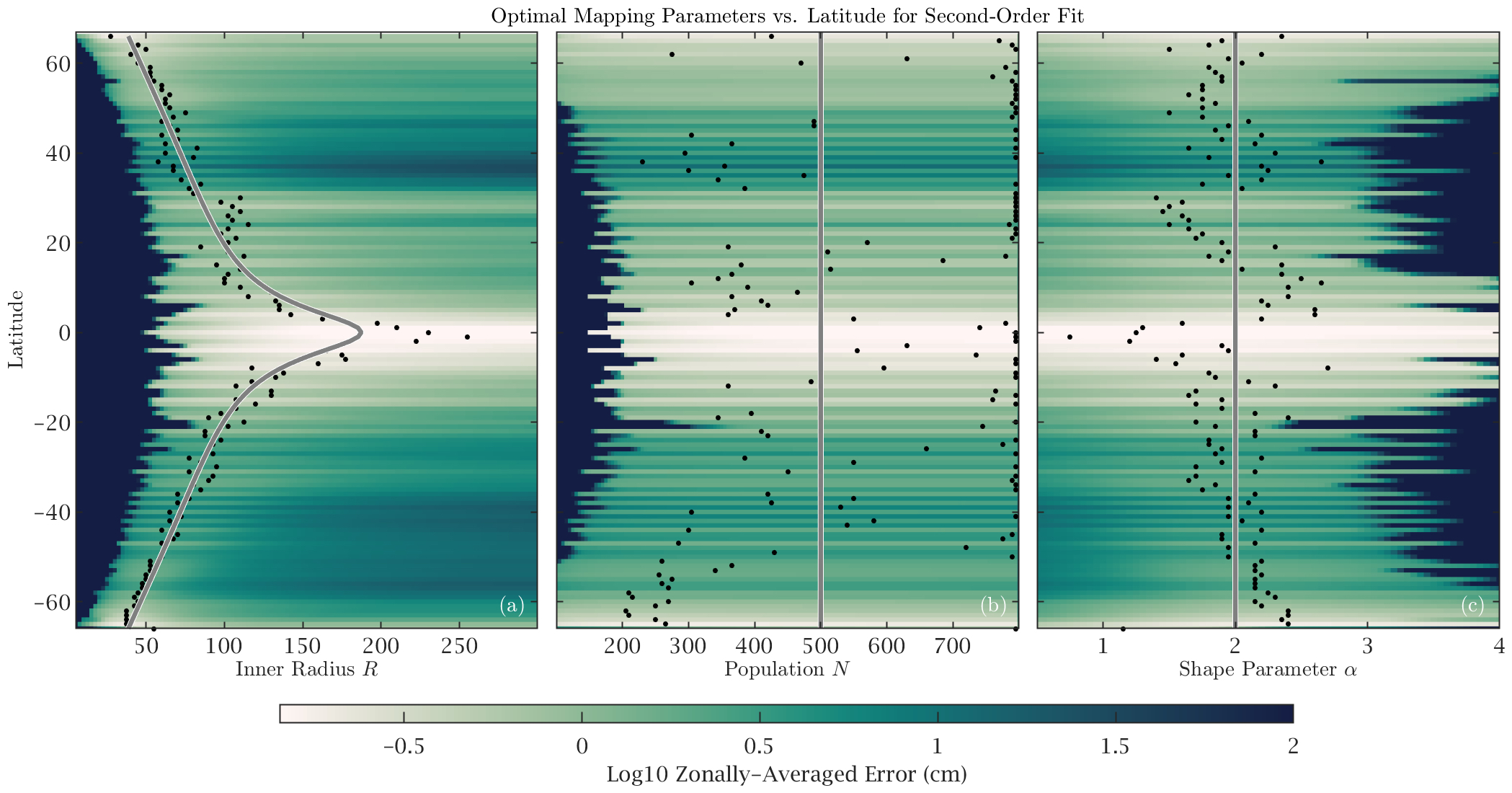
The key take-aways are as follows. First, the use of a fit of first or second order (that is, a fit to a plane or a parabolic surface) removes severe artifacts associated with the irregular spacing of the alongtrack data, in line with a well-known theoretical property known as design adaptivity. Second, the optimal radii—ranging from less than 50 km at high latitudes, to about 100 km at low latitudes, to around 180 km at the equator—are considerably smaller than those implied by the CMEMS mapping, suggesting the latter are oversmoothed. Third, weighting function shape is found to play a negligible role in map quality. Finally, further improvements are found to be unlikely because the remaining error is associated with curvature within regions of data gaps from which no information can be recovered.
The results from the OSSE are also compared with best-fit parameters inferred from so-called plug-in estimators, wherein an initial test map is used to deduce an optimal set of mapping parameters based on asymptotic theory. The plug-in estimates are found to be inferior to the OSSE-determined parameters, due primarily to the presence of sudden fall-offs in fit quality just beyond the optimal choices. Thus, while error estimates are of course an important part of the mapping process, OSSE type experiments are invaluable as a way to identify the likely best choice of parameters.
Suggestions are then given as to how these results could be used to improve future data products.

Contribution: IPC2023-Optimal_parameters_for_mapping_alongtrack_altimetry.pdf (pdf, 17510 ko)
Back to the list of abstract