Abstract's details
Regional mapping of short mesoscale ocean dynamics from altimetry
Event: 2023 Ocean Surface Topography Science Team Meeting
Session: Science III: Mesoscale and sub-mesoscale oceanography
Presentation type: Forum only
For over 25 years, satellite altimetry has provided invaluable information about the ocean dynamics at many scales. In particular, gridded Sea Surface Height (SSH) maps allow to estimate the mesoscale geostrophic circulation in the ocean. However, conventional interpolation techniques rely on static optimal interpolation schemes, hence limiting the estimation of non linear dynamics at scales not well sampled by altimetry (i.e. below 150–200 km at mid latitudes).
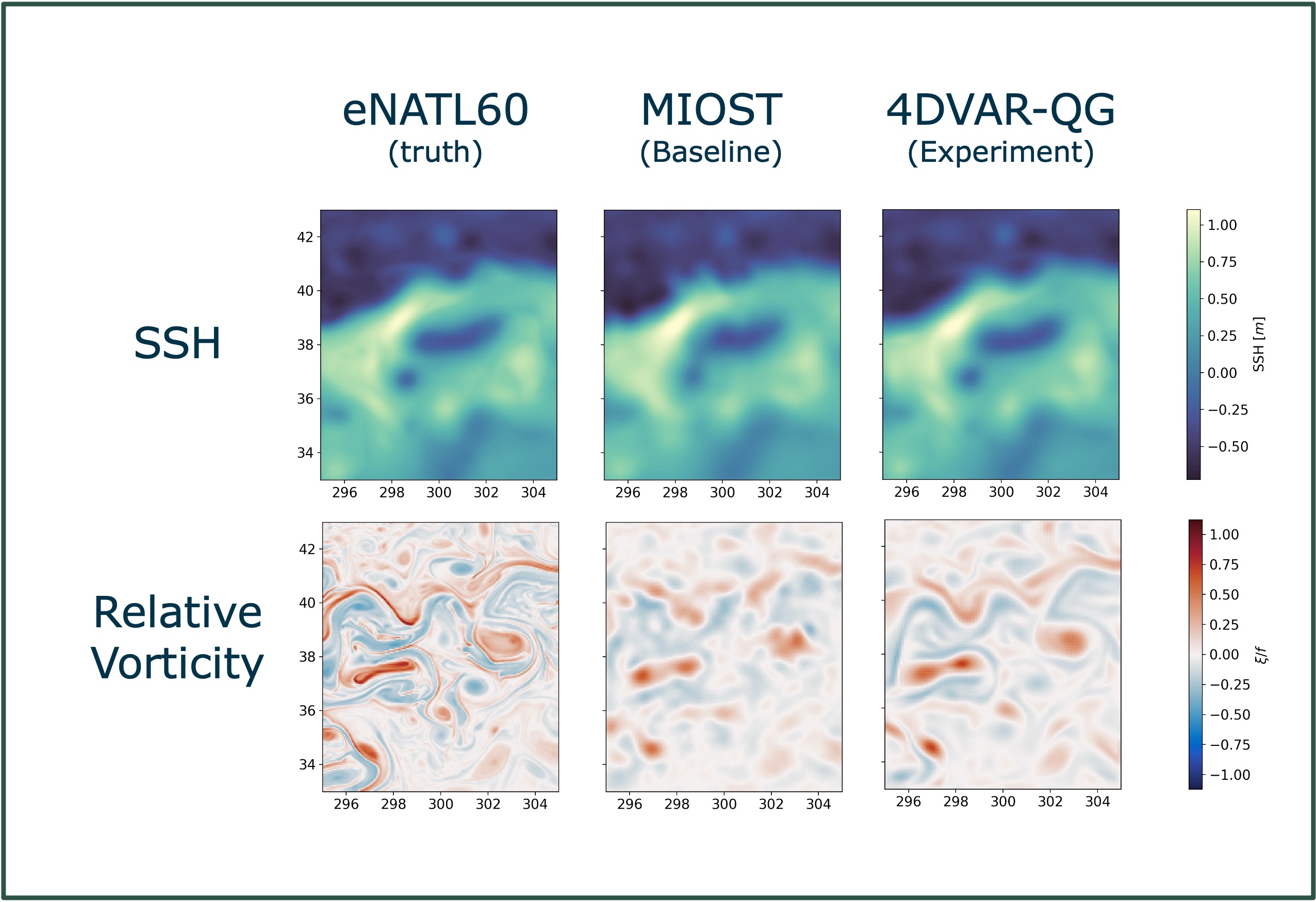
To overcome this limitation in the resolution of small-scale SSH structures (and thus small-scale geostrophic currents), we present a 4-Dimensional variational (4DVAR) scheme along with a Quasi-Geostrophic (QG) model (method called 4DVAR-QG). The method minimizes the error of the QG model compared to the observations. The convergence of the minimization is ensured by expressing the model error in a reduced wavelet basis.
The 4DVAR-QG method is applied to both simulated and real SSH observations in a region covering the Gulfstream current. The performances of the estimated maps are compared with the most recent operational and experimental products.
The results show that the 4DVAR-QG method improves the temporal (spatial) resolution of SSH maps by up to 50% (30%) compared with other products. The potential use of this method for mapping new SWOT data will be discussed.

Contribution: SC32023-Regional_mapping_of_short_mesoscale_ocean_dynamics_from_altimetry.pdf (pdf, 5313 ko)
Back to the list of abstract