Abstract's details
Oceanography and the search for Malaysia Airlines MH370
Event: 2014 Ocean Surface Topography Science Team Meeting
Session: Near Real Time Products and Applications and Multi-Mission, Multi-Sensor Observations
Presentation type: Poster
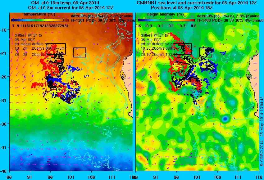
The fate of Malaysia Airlines MH370 is one of the most tragic and mysterious aviation incidents of all time. No physical evidence of the fate of the flight exists*, despite enormous international effort. The Australian Maritime Safety Authority (AMSA) coordinated the search of the sea surface from day 10 (18 March 2014) onwards. Vast areas of the Indian Ocean were searched by ~12 planes and ~12 ships until 28 April. CSIRO served as a member of the Drift Working Group, whose job was to estimate, each day, where winds and currents might have taken debris from the plane, given a range of estimates of where the plane might have crashed on 8 March. Members of the Drift Working Group used several estimates of the winds and near-surface currents (which were all, ultimately, dependent on altimetry for accuracy) to compute trajectories of potential debris items. In this talk I will discuss these trajectories, how they were computed and the uncertainties.
* (as at June 2014)

* (as at June 2014)
Contribution: 10-14_David_Griffin_flight_MH370_O_A_A0_PRINT.pdf (pdf, 3162 ko)
Back to the list of abstract