Abstract's details
The new daily global mesoscale Blended Ocean Surface Current (BOSC) product
Event: 2022 Ocean Surface Topography Science Team Meeting
Session: Application development for Operations
Presentation type: Poster
We describe design of the new 1/6° (mesoscale) resolution daily global Blended Ocean Surface Current (BOSC) product (analysis depths: 20 cm and 15m). This quasi-realtime data-informed product will eventually be available through NOAA CoastWatch for applications ranging from climate and weather analysis and forecasting to fisheries, marine debris, and coastal engineering. Looking forward, BOSC is designed to complement velocity observations from future Doppler satellite scatterometry.
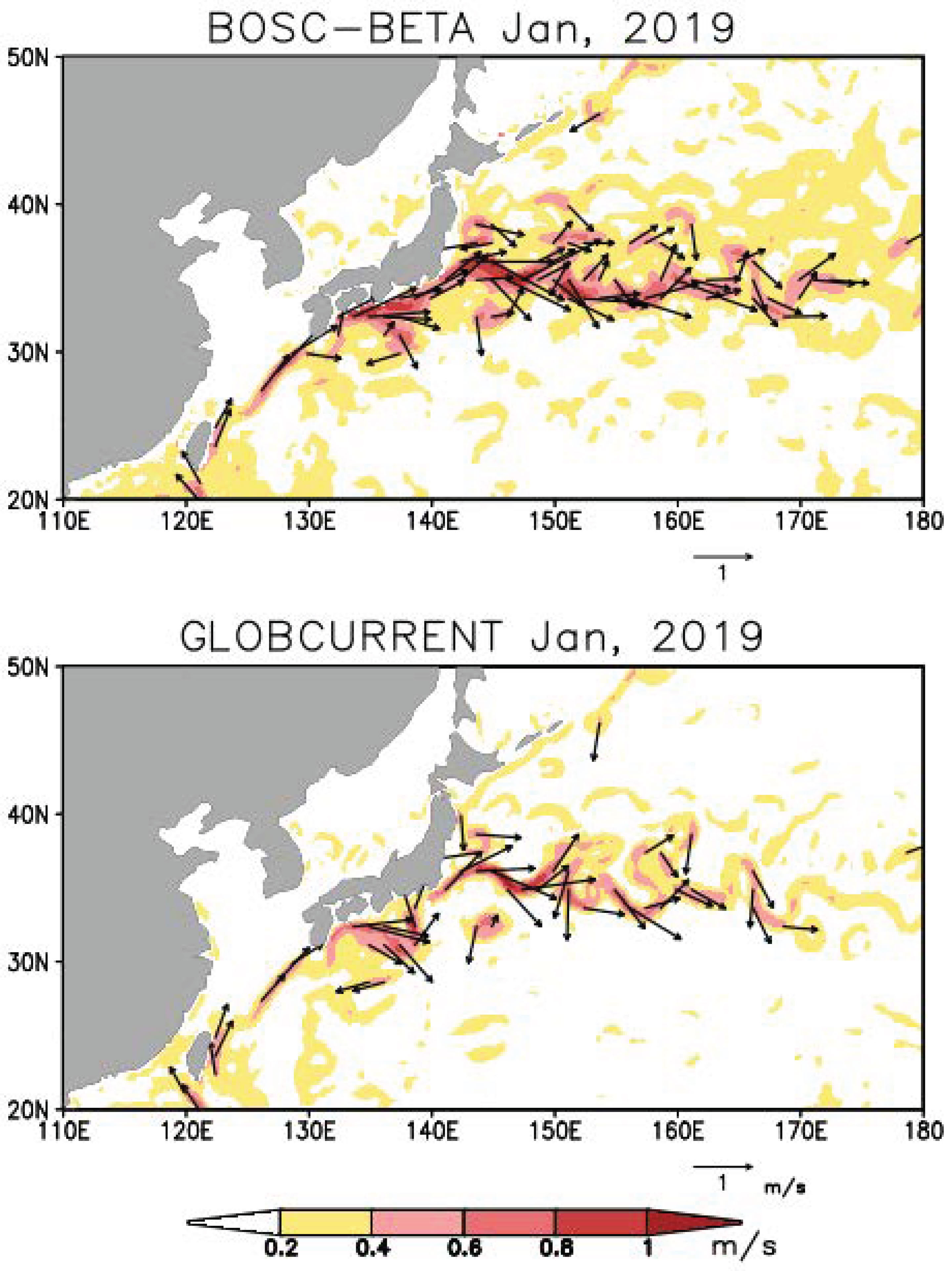
BOSC currents are constructed by summing gradient currents derived from the 1/4° resolution daily NOAA gridded multi-satellite sea level anomaly, with near-surface Stokes/Ekman currents derived from NOAA surface stresses and surface wave statistics, filled in with ice drift observations at high latitude. Satellite-derived SST constrains the mixed layer temperature equation to improve representation of meso-scales as well as coastal and tropical currents. Global Drifter Program drifter paths are used to constrain the time-mean currents at 15m depth. In addition to summarizing the theory and error analysis we show comparisons to two other widely used surface current products and to independent velocity observations for a two-year focus period: 2019-2020. Fig. 1 (upper panel) shows 15m BOSC currents in the Kuroshio/Kuroshio outflow region of the Northwest Pacific during the first month of our focus period.
Fig. 1 legend
Currents at 15m depth in the Kuroshio region of the western North Pacific, averaged during January 2019. Colors show speed while black arrows show vector velocity. Upper panel shows BOSC. Lower panel shows Globcurrent (www.globcurrent.org).

Contribution: APO2022-The_new_daily_global_mesoscale_Blended_Ocean_Surface_Current__BOSC__product.pdf (pdf, 1691 ko)
Back to the list of abstract