Abstract's details
CRISTAL performance assessment: an end-to-end simulation approach
Event: 2022 Ocean Surface Topography Science Team Meeting
Session: Science IV: Altimetry for Cryosphere and Hydrology
Presentation type: Poster
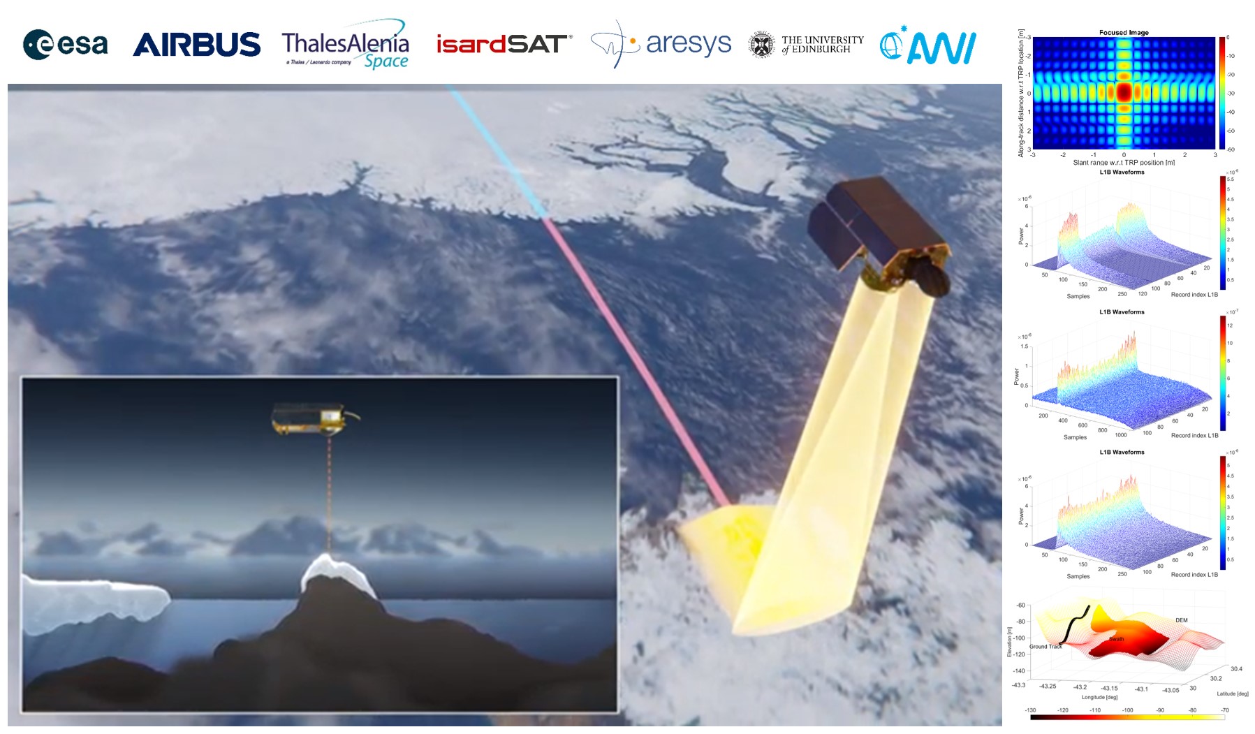
The Copernicus Polar Ice and Snow Topography Altimeter(CRISTAL) mission, planned to be launched in 2027 will incorporate a dual Ku/Ka-band interferometric altimeter with specific transmission pulse sequences designed to enhance the performances over sea and land ice. The open burst mode will enable the generation of Fully Focussed products over sea ice with snow depth retrievals derived from the Ku/Ka range differences instead of taking them from external auxiliary data. In the same way, as in CryoSat-2, the closed burst interferometric mode over land ice will allow the generation of swath elevations for the full Greenland and Antarctica, improving the current coverage of the CryoSat-2swath products that are only produced in the ice margins.
At this stage of the mission design, phase B2/C/D, the expected performances need to be evaluated against the requirements to verify the effectiveness of the mission configuration and assess its compliance.
In this framework, an end-to-end validation environment has been designed. It is composed of the System and InstrumentSimulator (SIS), the Ground Processor Prototype (GPP), and the Performance assessment tool (PAT).
Following the validation plan defined during the first stage of the project, the SIS will be in charge of generating datasets for the different scenarios that are foreseen to be of interest for the mission performance assessment (e.g. point targets, sea ice with different snow properties, ice sheet with small slope and uniform snow and ice characteristics, glaciers with different size, slope, and orientations, ocean tracks with different SWH and wind conditions, river and lakes for specific size and geometry).
The GPP will process the simulated data using different processing chains to ensure compliance with the functional and performance requirements. It is composed among others of Level1 Calibration chains, Level1 Low Rate chains(LR-RMC, LR Over-Sampled, and the conventional LR), Level1Delay Doppler chain, Level1 Fully Focussed chain, Level2retrackers module (compilation of different retrackers tailored for the different thematic surfaces), Level2Geophysical corrections and retrievals (translating the information from the retrackers into sea ice, land ice, ocean and inland waters measurements).
The PAT is in charge of closing the end-to-end chain: it will cross-check each of the geophysical parameters generated by the GPP against the corresponding requirement, starting from the knowledge of the simulated parameters, assessing and validating the end to end performance chain.
This presentation will give an overview of the expected performances of the CRISTAL mission based on the end-to-end validation activity carried out in this project.
Contribution: SC42022-CRISTAL_performance_assessment__an_end-to-end_simulation_approach.pdf (pdf, 1543 ko)
Back to the list of abstract