Abstract's details
GNSS/INS-Equipped Buoys for Altimetry Validation: Lessons Learnt and New Directions from the Bass Strait Validation Facility
Event: 2020 Ocean Surface Topography Science Team Meeting (virtual)
Session: Regional and Global CAL/VAL for Assembling a Climate Data Record
Presentation type: Forum only
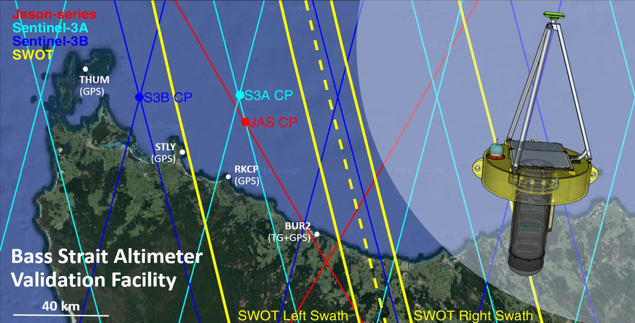
Global Navigation Satellite System (GNSS)-equipped buoys have a crucial role in the validation of satellite altimetry. Validation requirements for next-generation missions are necessarily demanding and call for a greater understanding of the systematic errors associated with the buoy approach. Here, we report results from a recently published study where we assessed the present-day buoy precision using archived data from the Bass Strait validation facility. We explored potential improvements in buoy precision by addressing two previously ignored issues. We initiated empirical modelling of the changes to the buoyancy position of the buoy as a function of external forcing applied on the tether. We also introduced an Inertial Navigation System (INS) unit to address the biases induced by orientation variations of the buoy platform in varying sea states.
Our study showed promising potential and sets the trajectory of the future buoy development at Bass Strait facility. Results indicated that the precision of our present buoy against in situ mooring data is ~15 mm, with a ~8.5 mm systematic noise floor. Based on regional numerical wind stress products and in situ current-meter measurements, the investigation into the tether tension effect on buoyancy showed strong correlation between currents, wind stress and buoy-minus-mooring residuals. Our initial empirical correction achieved a reduction of 5 mm in the standard deviation of the residuals, with an obvious energy attenuation over low frequency bands, especially in semi-diurnal band where dominant signals were seen in some buoy deployments. Corrections associated with platform orientation at GNSS observational level exhibited centimetre-level magnitude in our trial deployment and are expected to be higher under rougher sea states and with a larger buoy platform.
We conclude with further possible improvements of the buoy approach developed at Bass Strait based on the stringent validation requirements set out for the Surface Water Ocean Topography (SWOT) mission. First, our empirical tether model could be improved using high frequency in situ data collected by the shallow water current, waves and pressure inverted echo sounder (CWPIES). Second, using newly collected in situ mooring data we can formally quantify the biases caused by the previously unmodelled platform orientation. We can then better understand SSH across various frequencies and thus better contribute to altimetry validation using GNSS/INS-equipped buoys.
Contribution: OSTST_Oct_2020_AZ_et_al_final.pdf (pdf, 3427 ko)
Back to the list of abstract