Abstract's details
Near Real Time altimetry measurements of the storm surge Bodil, Denmark - comparison with model and in-situ observations
Event: 2014 Ocean Surface Topography Science Team Meeting
Session: Near Real Time Products and Applications and Multi-Mission, Multi-Sensor Observations
Presentation type: Oral
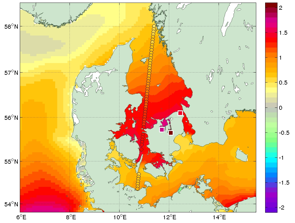
Altimetry provides a valuable tool in the mapping of storm surges. On December 6, 2013, the storm surge Bodil hit the north coast of the Danish island Zealand, causing severe flooding. Within the eSurge project, the event is used as a test case of the use of satellite altimetry in storm surge situations, and shows how Cryosat measures the event just a few hours after it peaked.
The transition zone between the North Sea and the Baltic Sea is an ideal location for validating coastal altimetry, since it is densely surveyed by tide gauges and several operational hydrodynamical models. It has a varied and challenging coastline, areas with and without tides, and large geographical variations in natural variability of the sea level signal, including variations in the intensity of storm surges.
Figure: The storm surge Bodil as modelled by DMI's ocean model HBM, as measured by Cryosat (circles), and as observed at the 3 most affected tide gauges on the north coast of the Danish island Zealand (squares).
Contribution: 29Red0900-4_OSTST2014_DMI_Bodil.pdf (pdf, 4043 ko)
Back to the list of abstract