Abstract's details
G-REALM: Investigating the Sentinel-3A data set for the next phase of Operational Lake and Wetland monitoring.
Event: 2017 Ocean Surface Topography Science Team Meeting
Session: Application development for Operations
Presentation type: Poster
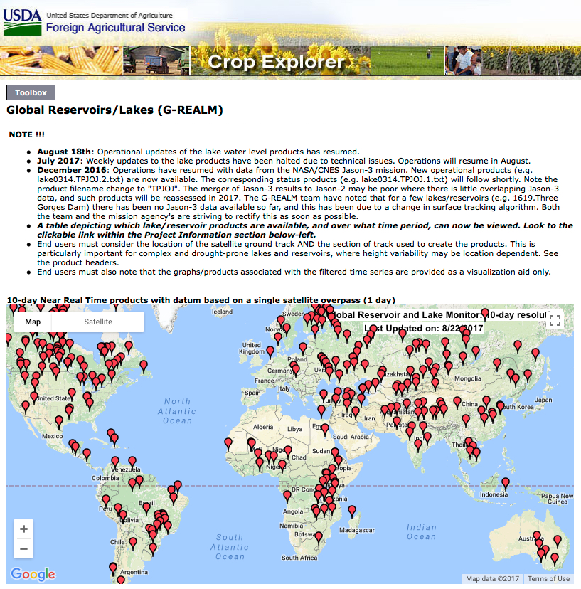
G-REALM is a NASA/USDA funded operational program offering water-level products for lakes and reservoirs that are currently derived from the NASA/CNES Topex/Jason series of radar altimeters. The main stakeholder is the USDA/Foreign Agricultural Service though many other end-users utilize the products for a variety of interdisciplinary science and operational programs. There is increasing demand for a more global monitoring service that in particular, captures the variations in the smallest (1 to 100km2) reservoirs and water holdings in arid and semi-arid regions. Here, water resources are critical to both agriculture and regional security. There is also demand for surface water level products across wetland zones in respect of inland fisheries and assessments of catch potential. In the next phase of the G-REALM program, focus is on the creation of near real time Sentinel-3A water level products, which will ultimately be merged with those derived from SARAL and ENVISAT. Operational Sentinel-3A products will assist observation of short-term agricultural drought, while the archival SARAL/ENVISAT products will help assess the longer-term hydrological drought.
Back to the list of abstract