Abstract's details
Toward Global Mixing Maps from Space
Event: 2016 Ocean Surface Topography Science Team Meeting
Session: Tides, internal tides and high-frequency processes
Presentation type: Oral
Mixing in the deep ocean is driven primarily by internal wave
processes--typically separated into the tidal, near-inertial, and
high-frequency components of the internal wave spectrum. Because a
major part of the mixing that drives the upwelling of abyssal and deep
waters is believed to result from internal tide breaking or scattering
into finer-scale waves, the spatial maps of the energy content and
dissipation of the internal tide (consequences of small-scale ocean
dynamics) are important fields required by climate-scale numerical
simulations.
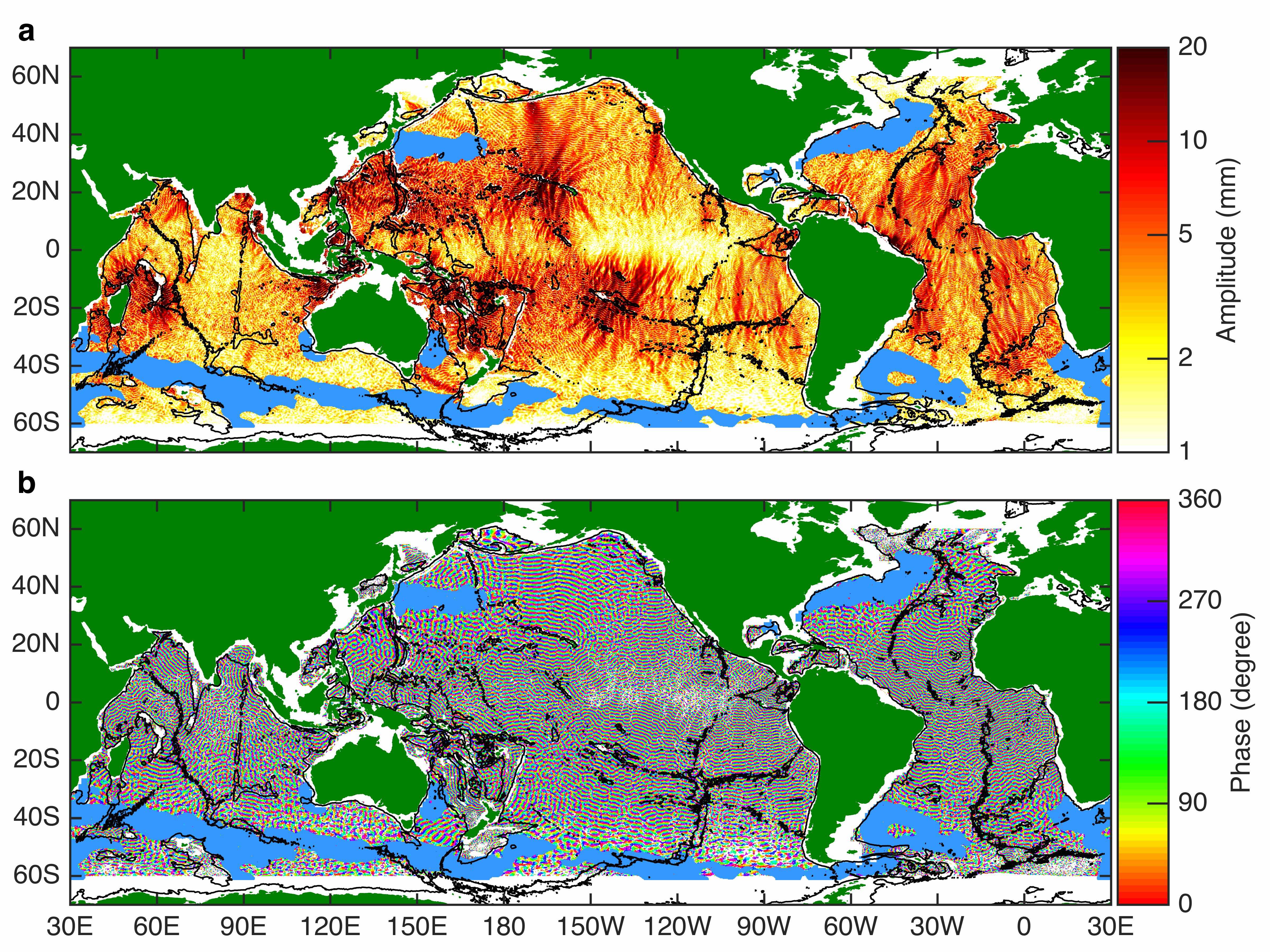
For several years, we have been developing and refining a technique
for extracting high resolution internal tides from baroclinic-mode
wave fits to the full multi-satellite altimeter record and have
recently published a global map of M2 mode-1 internal tides (see
figure). We feel that these new maps, which reveal a combination of
progressive and standing wave patterns from numerous internal tide
generation sites around the world, represent a valuable
characterization of both a significant SSH signal and an important
mechanism for energy redistribution within the oceans which has been
difficult to constrain with the sparsely-scattered in-situ
observations available.
In addition, profiling in-situ measurement platforms, including
moorings and floats, have improved our knowledge of the vertical
structure and partition of energy among tidal and other frequency
bands--leading to a two-dimensional (vertical wavenumber
vs. frequency) spectral description. A remaining missing piece is the
horizontal structure, which is dominated by the ill-constrained
low-mode, low-frequency end of the internal wave spectrum. Using
available measurements and some reasonable (but not fully validated)
assumptions, we suggest ways that the global Argo array (particularly
with enhancements such as horizontal and vertical velocity
measurements) can be used in conjunction with satellite data to
produce the maps of ocean mixing needed for long-term climate
simulations.
Contribution: TID_04_girton_iwaves_11h39.pdf (pdf, 3633 ko)
Back to the list of abstract