Abstract's details
Squeezing SARIn capabilities for complex scenarios: L1 & L2 processing improvements
Event: 2016 Ocean Surface Topography Science Team Meeting
Session: Instrument Processing: Measurement and retracking (SAR and LRM)
Presentation type: Poster
The CryoSat mission is designed to determine fluctuations in the mass of the Earth’s land and the marine ice fields. Its primary payload is a radar altimeter that operates in different modes optimised depending on the kind of surface: Low resolution mode (LRM), SAR mode (SAR) and SAR interferometric mode (SARin). This radar is named SIRAL: Synthetic aperture interferometer radar altimeter [1]. The SARIn mode uses two antennas allowing to compute cross-track angles at which signals arrives.
For scenarios with large topographical variations over short distances, a received SARIn waveform can sometimes have more than one peaks, so different elevations can be retrieved from a single waveform. Over certain regions with certain x-track slope conditions, the elevation profile x-track can be retrieved using the phase difference information.
Firstly with data from ASIRAS [2] and secondly with CryoSat-2 [3] data, the computation of surface elevation profiles over ice caps and glaciers using the so called "swath processing" proved the powerful capabilities of the SARIn mode, improving the spatial resolution of the elevation measurements.
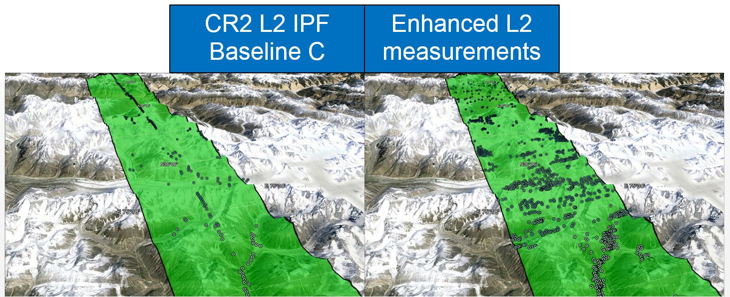
Improvements to the L2-swath processing approach have been investigated and implemented within the ESA founded projects CryoSat+ for Topography and CryoSat+ for Mountain Glaciers. The processing improvements are not only focused in the retracking algorithms but also on the algorithms that are applied in the early stages of the processing chain in order to clean the stack data, multi-looked waveforms and phase difference information as much as possible.
These new algorithm and improvements, initially designed for glaciers, have now been evaluated over other areas such as Coastal and Inland Waters.
[1] C.R. Francis, “CryoSat Mission and Data Description”, CS-RP-ESA-SY-0059.
[2] Hawley R.L., et.al.: Ice-sheet elevations from across-track processing of airborne interferometric radar altimetry, Geophys. Res. Lett., 36, L25501, doi:10.1029/2009GL040416, 2009.
[3] Laurence Gray et.al., Interferometric swath processing of Cryosat data for glacial ice topography , The Cryosphere, 7, 1857-1867, doi:10.5194/tc-7-1857-2013

Back to the list of abstractFor scenarios with large topographical variations over short distances, a received SARIn waveform can sometimes have more than one peaks, so different elevations can be retrieved from a single waveform. Over certain regions with certain x-track slope conditions, the elevation profile x-track can be retrieved using the phase difference information.
Firstly with data from ASIRAS [2] and secondly with CryoSat-2 [3] data, the computation of surface elevation profiles over ice caps and glaciers using the so called "swath processing" proved the powerful capabilities of the SARIn mode, improving the spatial resolution of the elevation measurements.
Improvements to the L2-swath processing approach have been investigated and implemented within the ESA founded projects CryoSat+ for Topography and CryoSat+ for Mountain Glaciers. The processing improvements are not only focused in the retracking algorithms but also on the algorithms that are applied in the early stages of the processing chain in order to clean the stack data, multi-looked waveforms and phase difference information as much as possible.
These new algorithm and improvements, initially designed for glaciers, have now been evaluated over other areas such as Coastal and Inland Waters.
[1] C.R. Francis, “CryoSat Mission and Data Description”, CS-RP-ESA-SY-0059.
[2] Hawley R.L., et.al.: Ice-sheet elevations from across-track processing of airborne interferometric radar altimetry, Geophys. Res. Lett., 36, L25501, doi:10.1029/2009GL040416, 2009.
[3] Laurence Gray et.al., Interferometric swath processing of Cryosat data for glacial ice topography , The Cryosphere, 7, 1857-1867, doi:10.5194/tc-7-1857-2013